34.5A BRIGGS STREET
Owner Information
RODRIGUES ROBERT JR & DIANA F
34.5A BRIGGS STREET
TAUNTON, MA 02780


Property Details
34.5A BRIGGS STREET is classified as a Single Family Residential (Colonial).
The primary structure on this property was built in 2013. There are 3,416ft2 of built area within this property. There is 1,840ft2 of residential/living space within this property. This property is listed as having 6 rooms.
34.5A BRIGGS STREET is valued at $313,800. The land is valued at $90,800 and the structures are valued at $221,800. There is an additional valuation of $1,200 on this property.
The most recent deed for 34.5A BRIGGS STREET is recorded at the local registrar in Book 21379, Page 0229. 34.5A BRIGGS STREET was last sold on Friday, October 18, 2013 for $250,000.
Assessment data from fiscal year 2021.
Flood Data
This property is partially within the AE Zone (within floodplain). Approximately 0.02 acres (4.91%) of the property is within this zone.
This information is sourced from the FEMA National Flood Hazard Layer. See our full disclamer.
Broadband Internet Providers
| Provider | Type | Bandwidth (mbps) | |
|---|---|---|---|
| T-Mobile | Fixed Wireless | 25 | 3 |
| GCI Communication Corp. | Satellite | 0 | 0 |
| HughesNet | Satellite | 25 | 3 |
| VSAT Systems, LLC. | Satellite | 2 | 1 |
| Viasat Inc | Satellite | 100 | 3 |
| Verizon New England Inc. | DSL | 10 | 1 |
| Verizon New England Inc. | Fiber | 940 | 880 |
| Comcast | Cable | 1000 | 35 |
Broadband service provider data from December 2020.
Adjacent Properties
- 34 BRIGGS STREET
Three-Family Residential owned by BUTTS MICHAEL C TR - 34.5 BRIGGS STREET
Other, Open Space owned by ANDREW E HOPGOOD & KAREN PATNEAUDE TR - 34.5 BRIGGS STREET #2
Residential Condominium owned by JONES TYLER A - 34.5 BRIGGS STREET #1
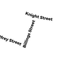
Residential Condominium owned by PATNEAUDE PAUL A & KAREN D TR - KNIGHT STREET
RES ACLNUD M00 owned by MEDEIROS JAMES R & LILAH A - 34.5B BRIGGS STREET
Single Family Residential owned by ANDRADE MANUEL & LUCIA DEANDRADE - 36 BRIGGS STREET
Three-Family Residential owned by REIS ELIZABETH TR - 38 BRIGGS STREET
Single Family Residential owned by REIS ELIZABETH TR